Tropical Storm Debby Update
- luehrsdon
- Aug 6, 2024
- 2 min read
Dry air circling into the tropical storm Debby, and the collapse of the center structure of the storm as it travelled over land today, changed the look of the tropical storm today. Here is the latest satellite loop and you can see there haven't been and thunderstorms near the center over the past few hours, and a large area of dry air northeast of the center. The center of the storm as of 11 pm has moved off the coast and back over water near Savannah, Georgia. Now that the center is back over water and forecast to stay over water the rest of tonight and tomorrow, Debby may try to "refill" and strengthen.

The impact of the dry air has been to make the rain more off and on, with long gaps between downpours, and thankfully that has reduced, but certainly not eliminate, some of the flooding impact up to this point across the Pee Dee and Grand Strand.
The latest forecast track from the NHC has tropical storm Debby turning to the north tomorrow and slowly approaching the SC coast, then making a landfall along SC coast, probably between Charleston and Georgetown tomorrow night. NHC does forecast slight strengthening prior to landfall with maximum winds of 50 mph.

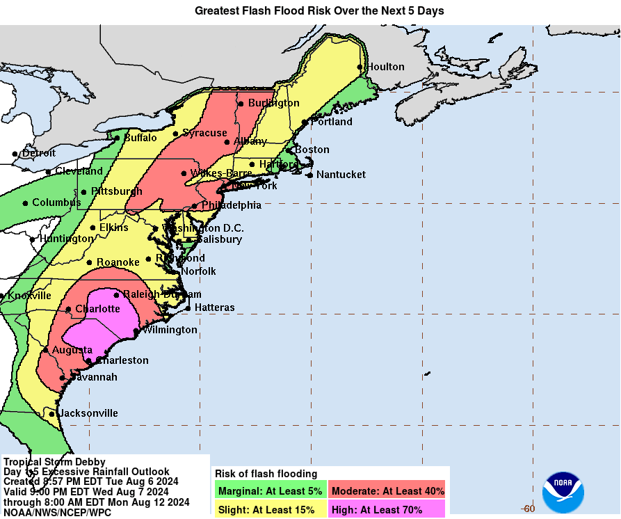
Rounds of showers and storms will increase tomorrow and continue into the night, and there is likely to be areas of flooding. Here is the latest prediction for additional rain from NOAA. They appear to be based on the tropical storm filling in well, and we'll have to see if that is the case as we go through tomorrow.

With the rounds of heavy downpours, the risk of flash flooding will be high.
Saturated ground and increasingly gusty winds could lead to some scattered power outages. For the Pee Dee and Grand Strand these will be most likely tomorrow afternoon and night. The European model is showing maximum gusts of 40 to 50 mph, but are probably a bit overdone. More likely for most areas would be 30 to 40 mph, still enough to knock down a few trees in saturated ground.


Comments